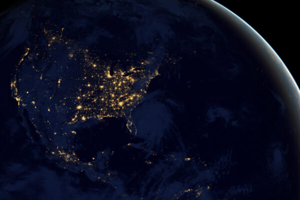
As residents stay home to prevent the spread of Covid-19, the images of barren cities have been eerie and unsettling. As we plan to re-emerge into the next phases of integrated society, cities have the opportunity to rethink their resiliency plans across a number of dimensions.
Urban planners, civic leaders, businesses and citizens alike need scenario-planning tools to help them reimagine safe, productive, equitable and enjoyable urban settings. Nobody knows exactly which of our current behavior patterns will endure — from more biking to less eating out — but we do know that we must adapt to today’s constraints, anticipate future disruptions and be prepared to react more swiftly. Cities must explore how resiliency measures such as distributed energy resources, multi-modal public transportation, DTC supply chains, broadband networks and affordable housing enhance their sustainability over the longer term.
Enter UrbanFootprint, a cloud-based, scenario-planning software created by world-class urban planners to help make cities more livable. The company’s software empowers corporations, governments and citizens to simulate development plans for the built environment, while accurately accounting for factors such as housing constraints, environmental impact, traffic congestion and proximity to public transportation.
At Valo Ventures, we champion digital technology companies just like UrbanFootprint that apply innovations to the physical world in order to improve the quality of life for future generations. I sat down with Joe DiStefano, CEO and co-founder of UrbanFootprint, and Scott Tierney, one of our Valo Ventures partners, to hear more about their vision for how UrbanFootprint can create better and faster solutions for communities.
Half the global population lives in urban cities today, and that is forecasted to increase. How does UrbanFootprint fit in?
JD: Urbanization and the migration to cities has happened pretty dramatically. UrbanFootprint gets ahead of the problem by enabling well-planned cities to factor in mobility, air and water quality, infrastructure and, ultimately, consumer empowerment and quality of life. Today, it can take urban planners multiple years and millions of dollars to collect a set of data that pulls in all of these variables. UrbanFootprint reduces that to a matter of minutes through clean and curated data that covers land use and development conditions, transportation systems, ecology, hazard risk and socio-demographics. And it allows people to quickly understand the impacts of interventions on key indicators such as GHG emissions, public health and fiscal efficiency.
One of UrbanFootprint’s superpowers is its powerful data mining technology and modeling capabilities. How is UrbanFootprint helping understand and predict the spread of Covid-19?
JD: Our national data core, and the ability to bring in data to understand the highly dynamic nature of this crisis, sets us up to deliver rapid insight. Metrics that were once considered relatively static — like unemployment, hospital capacity or transit service levels — are now highly volatile and distributed unevenly across the landscape. Things have gotten a lot more complex. UrbanFootprint is helping major frontline organizations and state agencies decide where to site critical services, relief programs and testing.
For example, we are helping agencies and relief providers in the state of Louisiana map how vulnerable their population is to economic stress, unemployment, food access and health challenges. By collecting and analyzing a wide variety of static and dynamic data — from Covid-19 caseloads to transit access to relief applications — we found that more than ⅓ of the state’s population lives in areas with low food security, exposing more than 1.6 million people to increased health risks. We then used our data-driven insights to support local food relief providers in understanding how to deploy limited resources more effectively and more equitably.
What’s another question that a user might plug into the software?
JD: Let’s say a city planner wants to know where to build affordable housing within a densely populated area. It’s not just a matter of space, but proximity to hospitals, transportation and public parks. It’s also a matter of how development would impact traffic patterns and GHG emissions. Again, historically this is a process that has taken years. But within a matter of minutes, UrbanFootprint will narrow a specific set of options for that city planner so that she or he can build an informed plan and test ideas.
And what percent of the US does UrbanFootprint’s data set cover?
JD: Right now, we can run analyses across all 50 states in virtually every urban area. We cover more than 120 million parcels of land, or about 95% of the US population. We can run the analysis that was completed for New Orleans above for every city in the country.
What differentiates UrbanFootprint from other urban planning software companies?
ST: Beyond offering unprecedented access to hundreds of different data sources, UrbanFootprint makes it frictionless to aggregate, analyze and visualize the data, and then share them between stakeholders. One thing I’ve learned from my time at Google is that data have so much greater value if they’re easy to collaborate around and access. UrbanFootprint’s sophisticated mapping technology makes it seamless for planners, companies and agencies to illustrate their goals and constraints with the same ground truth data. That saves time and enables decision-makers to have more sophisticated, data-informed conversations about citizens’ well-being.
Who are UrbanFootprint’s customers? What’s an example of how a customer is using the software?
ST: The founders, Joe and Peter, wanted to scale this analytical framework beyond the urban planning industry. Architects, engineers and planners represent a core customer base but UrbanFootprint is now being used by city and state agencies as well as corporations and utility companies. For example, Pacific Gas and Electric is using the software to understand the impact of heat waves on their communities and to address fire risk within their grid. The city of San Diego uses the software to help prioritize land use projects in different neighborhoods. Providence Health Care uses the platform to understand the communities they serve and for Covid-19 response planning.

What made UrbanFootprint and the company’s founders, Joe DiStefano and Peter Calthorpe, stand out to you?
ST: Some of the world’s most high-profile companies have been born from purpose-driven founders solving a problem that they confront in their own respective professions. For Peter Calthorpe — a renowned expert on architecting cities all around the world — and Joe DiStefano — head of the planning and scenario modeling practice at Calthorpe Associates and an urban planner with more than 20 years of experience — that was urban planning. The software was born out of Joe’s frustration with the existing urban planning software, and he built an internal tool to help manage all the dynamic, external data needed in building cities. Eventually the software was spun out of Calthorpe Associates, and UrbanFootprint was born.
Both Joe and Peter have deep domain knowledge about how data can help planners design better infrastructure projects and help regulators grant approvals in a timely manner — critical steps for getting things built.